Skip to content
Tags
DL-SLAM: Enabling High-Fidelity Gaussian Splatting SLAM in Dynamic Environments based on Dual-Level Probability

DL-SLAM: Enabling High-Fidelity Gaussian Splatting SLAM in Dynamic Environments based on Dual-Level Probability

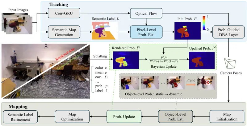
Recent advances in 3D Gaussian Splatting (3DGS) have enabled significant progress in dense dynamic Simultaneous Localization And Mapping (SLAM). Prevailing methods typically discard predefined dynamic objects, ignoring that transiently static objects offer valuable geometric constraints for pose estimation. A recent work attempts to leverage this potential by employing per-pixel uncertainty maps to quantify the magnitude of motion. While this approach enables transiently static objects to enhance pose estimation, it erroneously integrates these objects into the static map, resulting in persistent artifacts. Moreover, its reliance on purely geometric information leads to ambiguous object boundaries in the uncertainty maps. To overcome these limitations, we present DL-SLAM, a monocular Gaussian Splatting SLAM system built upon a novel dual-level probabilistic framework. Our method computes dynamic probability maps by combining semantic and geometric information. These pixel-level probabilities are lifted to 3D and aggregated to derive an object-level dynamic probability for each instance. Object-level probability enables the categorical pruning of dynamic Gaussians, resulting in an artifact-free static map. The static map, in turn, provides a geometrically consistent guidance to refine the pixel-wise probabilities, enhancing their reliability. Experimental results demonstrate that DL-SLAM outperforms existing approaches, improving tracking accuracy by up to 13% while generating high-fidelity semantic maps.

Ziheng Xu, Qingfeng Li, Xuefeng LiuJul 2, 2026
Dynamic EnvironmentSLAM3D Gaussian SplattingJul 2, 2026
Ouster OS0 Ultra-Wide View High-Resolution Imaging Lidar

Ouster OS0 Ultra-Wide View High-Resolution Imaging Lidar

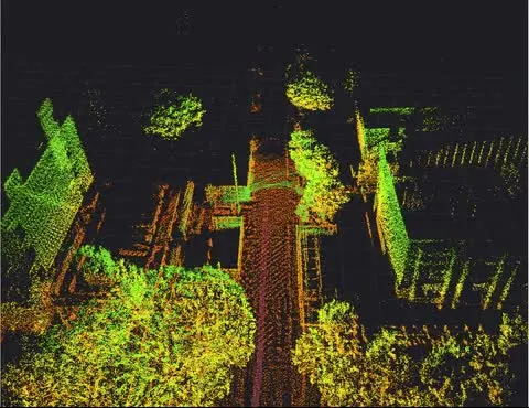
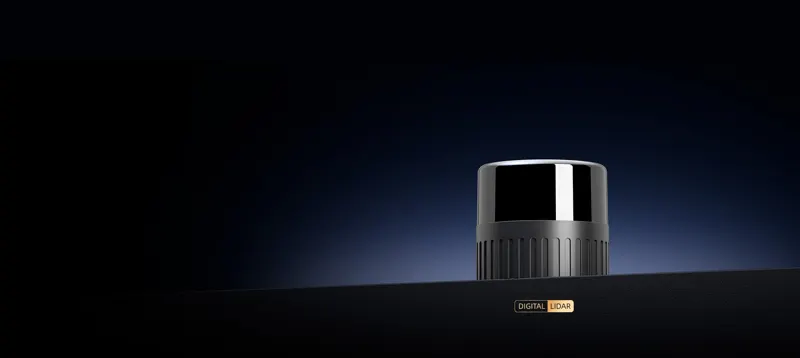
The Ouster OS0 is the Rev8 ultra-wide short-range imaging lidar: 90 deg vertical FOV (+45 to -45) and 360 deg horizontal, 32/64/128 channels, 512-4096 horizontal columns (0.088 deg angular resolution at 4096) and 5-40 Hz configurable rotation. In 1024 @ 10 Hz mode it reaches 75 m on 80% Lambertian targets and 35 m on 10% targets, both at >90% detection probability under 100 klx sunlight, with 500 m max representable range and a minimum range configurable down to 0 m (0.5 m default, 0.3 m optional). Range accuracy is +/-1.25 cm (Lambertian) / +/-2.5 cm (retroreflective) - 2x better precision and accuracy than Rev7 - at 0.1 cm range resolution, with up to 2 returns and 10,485,760 points per second; the 865 nm laser is Class 1 eye-safe. Native RGB-D color point cloud (116 dB dynamic range) carries RGB, range, signal, reflectivity, NIR, channel, azimuth and timestamp per point, with a synchronous IMU at 640/1280/2560 Hz. Data leaves over gigabit Ethernet UDP with PTP/gPTP/NMEA/PPS time sync (<1 ms error) and <10 ms latency. It runs from 12/24 VDC (9-58 V) at 10-20 W, measures 87 mm diameter x 58.35 mm and weighs 500 g (580 g with halo cap); IP68/IP69K, -40 to +85 C (Rev7 was +60 C), 100 g shock, 10 Grms vibration and MTTF over 250,000 h. Engineered for functional safety (ASIL-B, SIL-2, PLd) with an on-sensor 3D Zone Monitor and designed for cybersecurity to ISO 21434 / UNECE WP.29 / IEC 62443 / ISO 27001. Built for AMRs, AGVs, inspection robots, heavy machinery, drones and mapping solutions that need close-range blind-spot perception and high-accuracy 3D modeling.

COMPONENT

LiDAROusterRGB-DUltra-Wide AngleShort Distance